About Lindelse NorOne of the really unique features of Lindelse Nor and the South Fyn Archipelago is that much of the sea bed is in fact the submerged stone-age landscape. As the ice melted at the end of the last ice age, sea levels rose and much of the prehistoric landscape is now under water, and here at Højklint it is still possible to see tree stumps and the trunks of fallen trees from Stone Age forests, lying in the open on the sea bed. It is also possible to find traces of the human population that lived here at that time, for example, in the form of worked flints.
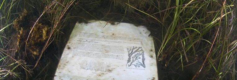
Normally a site such as Lindelse Nor would not attract many divers, but an underwater path has been established that can be used by both divers and snorkelers. The water depth is rarely more than 2 - 3m, the path 500m long and takes diver past 7 different information points. You follow a line that is tethered on the bottom, which will take you to the information points that tell divers about the Stone Age, the “drowned” forest, and the animals and plants that can be found here today.
The whole area is covered by large beds of eelgrass, which provides shelter to plenty of marine life. Sea-squirts can often be found growing on the eelgrass, and there are many pipefish and other small fish that make their home amongst the eelgrass. But in the dense plant beds you really must have good eyes to see these fish, as they are perfectly camouflaged in this environment.
The waters of Lindelse Nor are shallow and the sea bed soft, but despite of this it is also possible to find larger fish such as flounders and eelpout here. They can suddenly come swimming out of nowhere, and marvel as much as the diver or snorkeler over such unexpected meetings.
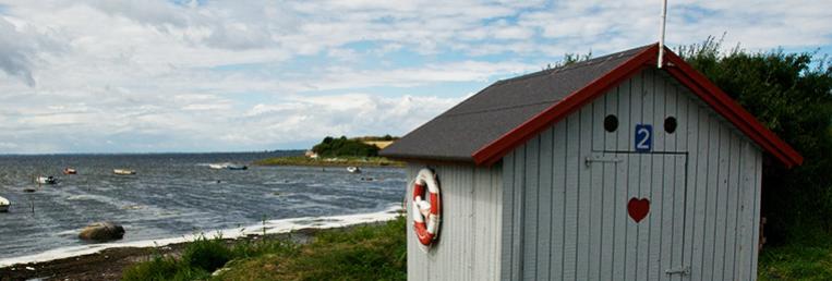
Lindelse Nor is best when the wind is in the east as the cove is open to the west. Divers will find it easiest and most comfortable to enter the water by first walking a little way along the beach to the low cliffs, as the sea bed if very soft and makes for difficult wading. From the parking place you can see a white buoy tethered in front of these low cliffs, this marks the start of the underwater path.
How to get here: from Rudkøbing drive along route 305 in the direction of Bagenkop. Around 5km south of Rudkøbing turn right along Klæsøvej, and follow this road until it ends at a parking place next to the beach.
From the foot of the low cliffs a white buoy can clearly be seen, which is where the underwater path starts, and the first information point. Walk along the beach to these low cliffs, as the seabed close to the beach is very soft.
|