About The BinzThe small, German warship The Binz originally sailed as a steam ferry from Rügen, but underwent conversion during the First World War. On 15th December 1915, she hit a mine in the Langelands Belt, the resulting explosion breaking the ship apart. It now lies in two separate sections 9m from each other.
The aft section of the wreck has largely disintegrated, but around the wreck lie a few cases containing ammunition, which together with the Russian rifles that were found on the wreck testify to the ships wartime function. At the stern it is still possible to see the ship’s steering gear, which is still reasonably intact and makes a fine subject for photographers.
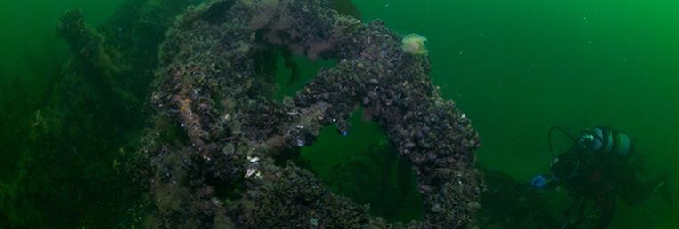
The forward and most intact part of the wreck includes the hold, which you can swim through. On your way you can see details of the timber construction, but be careful to keep clear of the mud. The wreck is often home to large cod, which may hide themselves in the hold or under the many collapsed parts of the wreck, so do remember to bring along a torch.
The bow of the ship is still standing upright, and the flagpole is still in place - even though it is bent at an angle of 90 degrees to starboard.
The whole wreck is beautiful encrusted with life, especially mussels, and there are large mussel beds growing around the ship. On the seabed close to the wreck you can find parts of the ship that the currents and the ravages of time have broken off. Even though it is one of the oldest wrecks in the Langelands belt, it offers a wealth of attractions.
Be aware that the wreck lies in the shipping lane, and you must take into account the very large ships that sail here. It may be necessary for boats to cast-off from the wreck, in which case the divers must be able to take care of themselves. |